


C1847 Antique France Map, Levasseur Map of the Dept. de L'Ardeche, hot France, Region du Sud Est #6
1847 Antique Map of the Dept. de L'Ardeche, Victor Levasseur (cartographer)
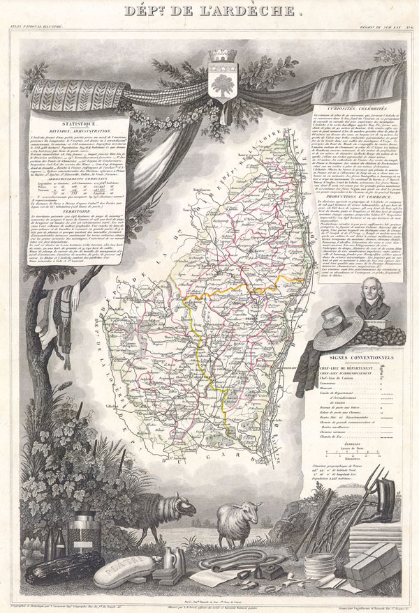
Elaborate decorative engravings illustrating the natural beauty and the trade richness of the land.
Geographie et Statistique par V. Levasseur Ing. Geographe, Rue duTemple, 46
Illustre par A M Perrot, officier du Genie et Raimond Bonheur peintre
Paris, chez l'Editeur Rue de la Parcheminerie, 15
Grave par Laguillermie et Rainaud, Rue St. Jacques, 82
This is a fascinating 1847 map of the Department de L'Ardeche, France. This region is known for its fine wines, agriculture, distilled spirits, and cheese. The capital city is Privas. The whole is surrounded by elaborate decorative engravings designed to illustrate both the natural beauty and trade richness of the land. There is a short textual history of the regions depicted on both the left and right sides of the map.
20" x 14"
Great color - very good condition
Aged but no rips or tears hot